

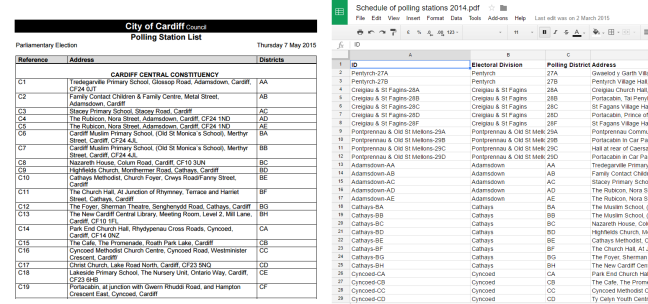
Cardiff Council publish a list of polling stations as a PDF.
Cardiff Hyperlocals wanted to map this data and present it in a more accessible format.
They used a tool called import.io to scrape the data from the PDF into a spreadsheet.
They then used a service called Silk to geocode the address column and map the polling stations.
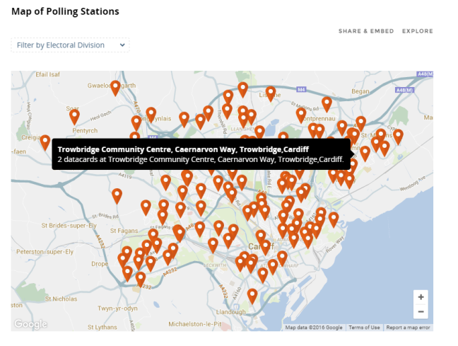
This map can be embedded in another website and the data can be filtered by electoral division.
